★★★★★
“DXF Map great - couple of problems getting my Turbocad (2023( to accept importing it, had to get it converted on line to the common 2018 level.”
 Planning Maps UK
 Site, Block & Location Plans from £7.95. Instant PDF & CAD.
Create site, location and block plans as PDF or CAD files using official Ordnance Survey MasterMap Topography data. Perfect for land registry and council applications.
Acceptance Guarantee
If a planning authority flags a PlanningMapsUK map-preparation or compliance fault, we'll review it and correct the affected map free of charge.


Our data partners

Trusted across the UK

Customer reviews
Honest feedback from people ordering planning maps, CAD plans, and boundary reports.
4.9 from 19 reviews
“DXF Map great - couple of problems getting my Turbocad (2023( to accept importing it, had to get it converted on line to the common 2018 level.”
“The planning map bundle was delivered very quickly but initially missed an essential area of coverage. However this was corrected within a couple of hours. The plans were submitted to the council planning department and accepted.”
“Excellent & clear communications (mon-Fri). When additional assistance was needed with the accurate scaling and plotting of a site for TP1 the support team responded immediately. I gave the measurements and was provided with a pdf to scale with boundaries drawn & requested annotations clearly marked. Highly recommended”
“We generated our planning application via the Planning Portal, but then our local council asked for a 'Layout' or block plan, showing scale, paper size etc, before they would validate it. We thought we were going to have to pay for a professional but found this site online and it worked perfectly. Good choice of scales, based on OS maps, choice of position etc. We set up our plan, downloaded it, added a few labels, sent it in, and the council finally validated our application.”
“All went well and was accepted by the council.”
“The application was easy to use via the portal, follow up from Manchester Building Control was very quick, thanks”
“Because I wanted a dwg file and had old software, at first iI could not open the file sent to me. They were very helpful and after a couple of tries it was successful. Many thanks”
“Brilliant service and support from the staff”
“Excellent service easy to read.”
Choose your map
Buy site, block, location or rural plans in colour or black and white using the Ordnance Survey MasterMap Topography Layer. Available as PDF and CAD files (DWG & DXF). Suitable for all users including planning applications and land registry compliant. Perfect for all UK applications in england, wales and scotland.
Bundle base price£31.95
A location plan and a detailed site plan together for your planning application.
CAD from£14.95
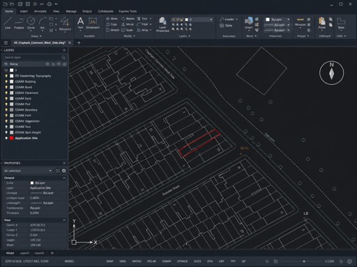
Editable OS MasterMap linework or Colour Pop for your design workflow.
Individual PDF plans
Choose the scale and coverage that fits your site.
Close detail for a small site, extension, driveway or dropped kerb.
Show your property, nearby buildings, boundaries and access.
Place an urban site among surrounding roads and neighbouring plots.
Include more surrounding land for rural and larger properties.
Show an estate or extensive site and its wider setting.
See a broad area around major land or infrastructure projects.
Coverage ranges include available paper sizes and orientations. Starting prices are for the A4 portrait PDF pictured. CAD starts at 1:200 / 0.1 ha. Other sizes, coverage and optional add-ons are priced in the builder.
Explore every A4 sample and coverageExamples show King's College and the River Cam, Cambridge, and are marked EXAMPLE. On-screen previews are for comparison; purchased PDFs are supplied at print scale. © Crown copyright and database rights 2026 OS.
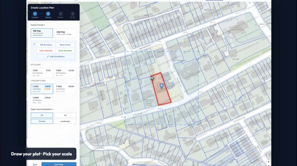
Use our simple OS mapping software to search your address, set your boundary, choose your scale and purchase planning ready site and location plans in less than 60 seconds.
We provide OS planning maps for homeowners and professionals who need fast, council-ready outputs in PDF and CAD formats.
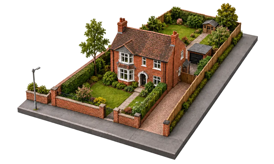
Generate detailed block plans at 1:200 or 1:500 with licensed OS mapping and clear boundaries for submission-ready packs.
Create compliant location plans at 1:1250 (2, 3, 4, or 5.1 ha), 1:2500 (10, 15, or 20 ha), or 1:5000 (50 ha and above), edit the red line boundary, and export council-ready PDF or CAD files.
All UK planning scales covered — 1:200, 1:500, 1:1250 and 1:2500 — on A4 or A3, portrait or landscape, in PDF or CAD.
UK councils require specific things on every site location plan. We build all of them in by default — so the map you download is council-ready the first time.
Draw a precise red line around the full application site (building, gardens, driveways and access to the public highway), and add a blue line for any other adjacent land you own.
1:1250 for urban sites, 1:2500 for rural context, plus 1:200 and 1:500 block plans — all printed correctly to A4 or A3 so the scale stays accurate.
A clear north arrow and at least two named roads are included on every plan, helping the planning officer locate your site on the ground.
Enough surrounding buildings and boundaries are shown to clearly identify the site in its setting — never a cropped or zoomed-in fragment.
Up-to-date, fully licensed Ordnance Survey mapping. No Google Maps screenshots, no Land Registry title plans, no copyright issues.
Every plan displays the OS Crown Copyright acknowledgement and a valid licence number, exactly as planning authorities expect.
Want the full guide?
Read our complete 2026 UK planning application requirements breakdown.
Preview the map and check your boundary before you order.
Council Compliance
Most map rejections come down to red line errors, wrong scale, or unlicensed base mapping.
Choosing licensed os planning maps helps reduce preventable validation issues at upload stage.
Rule 1
Your application site must be clearly edged in red and include all land needed for the proposal.
Rule 2
Planning maps typically require 1:1250 and 1:500 outputs with a clear north indicator.
Rule 3
Councils expect current Ordnance Survey MasterMap data with a valid license reference.
PlanningMapsUK Example
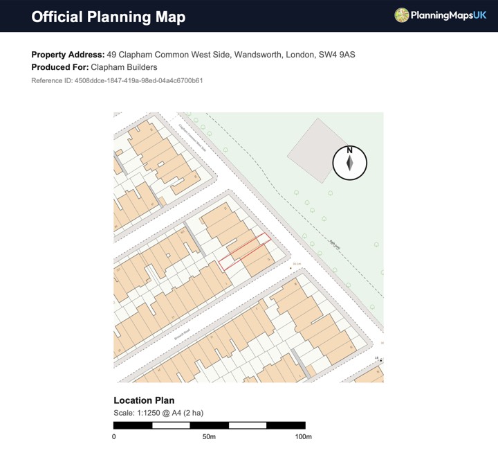
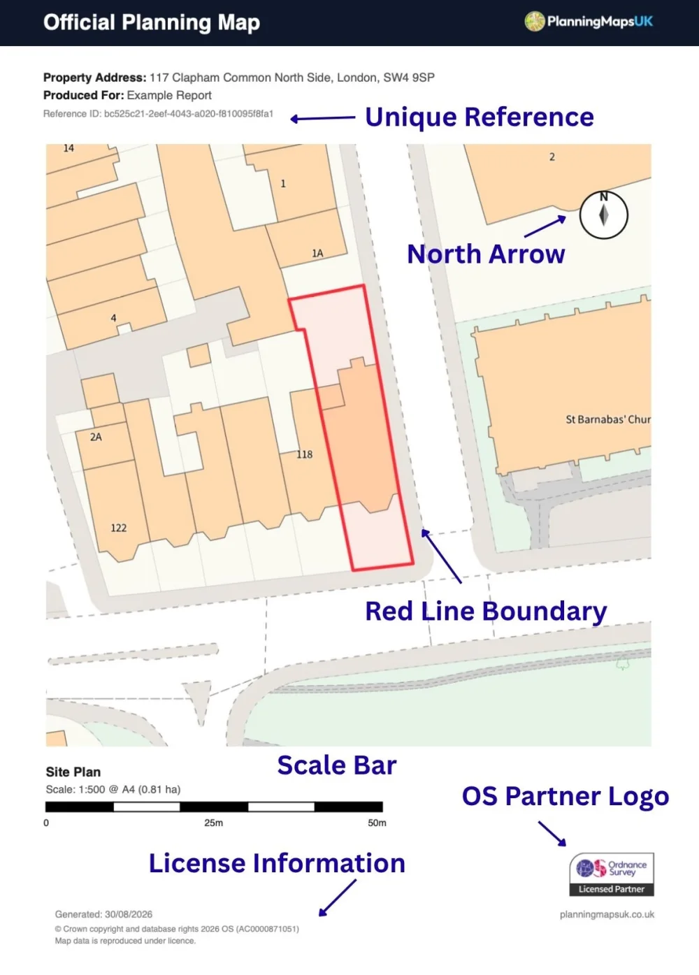
A clear planning map combines the correct scale and site boundary with the north arrow, scale bar, unique reference and licensed Ordnance Survey information needed to identify the drawing.
Perfect For Any Project
From simple householder applications to complex commercial submissions, our mapping tool produces exactly what your planning officer requires.
Most Common
Typical rear extension layout
The most common use case. Generate a 1:1250 location plan for the wider context and a 1:500 block plan detailing the new footprint of any single or double-storey extension, garden room or garage.
Block and location plans for dormers, hip-to-gable and roof alterations.
1:1250 + 1:500
Loft conversion map guide →Commercial to residential, HMO conversions and other Use Class changes.
Location Plan
Commercial premises map guide →New driveways and hardstandings showing access to the public highway.
Block Plan
Create a driveway block plan →Highways applications for new vehicle crossovers and access points.
Highway Authority
Dropped kerb map checklist →Garden offices, studios and outbuildings that need a block plan submission.
1:500 Block Plan
Garden room map guide →Show the proposed charger location and its relationship to the highway.
Block + Location
Create the site-detail plan →Renewables installations including PV arrays, ASHPs and battery storage.
Permitted Dev.
LDC planning map guide →Heritage-sensitive sites including listed buildings and Article 4 zones.
Heritage Consent
Conservation area map guide →Works to protected trees requiring formal council notification.
TPO Notice
Heritage and tree map guide →Internal reconfiguration, window replacements and external facade changes.
Householder App.
DIY renovation map guide →Boundary walls, decking, fencing and ground level changes to gardens.
Block Plan
Create a landscaping block plan →Self-builds, infill plots and replacement dwellings on residential sites.
Full Application
New-build map guide →Not sure where to start?
Our scale and plan choosers walk you through the right output for your specific application.
Compare a site plan, site location plan, 1:500 block plan, or the complete OS planning maps workflow.
Need to show existing trees or canopy spread? Use the tree map annotation tool to add them to your plan.
Choose the right scale, paper size, and printed-copy option for your project. All plans are OS MasterMap® accredited.
| Map Type | Scale | Coverage | Area | Price |
|---|---|---|---|---|
| Site Plan | 1:200 | 35m x 35m | 0.12 ha | £7.95 |
| Block Plan | 1:500 | 90m x 90m | 0.81 ha | £14.95 |
| Location Plan | 1:1250 | 141m x 141m | 2 ha | £20.50 |
| Location Plan | 1:1250 | 173m x 173m | 3 ha | £27.95 |
| Location Plan | 1:1250 | 200m x 200m | 4 ha | £33.95 |
| Location Plan | 1:1250 | 225m x 225m | 5.1 ha | £39.95 |
| Rural / Estate Plan | 1:2500 | 316m x 316m | 10 ha | £59.95 |
| Rural / Estate Plan | 1:2500 | 387m x 387m | 15 ha | £69.95 |
| Rural / Estate Plan | 1:2500 | 450m x 450m | 20 ha | £79.95 |
| Large Scale Location Plan | 1:5000 | 707m x 707m | 50 ha | £114.95 |
| Large Scale Location Plan | 1:5000 | 866m x 866m | 75 ha | £154.95 |
| Large Scale Location Plan | 1:5000 | 894m x 894m | 80 ha | £212.95 |
| Regional Context Plan | 1:10000 | 1789m x 1789m | 320 ha | £394.95 |
| Map Type | Scale | Coverage | Area | Price |
|---|---|---|---|---|
| Site Plan | 1:200 | 50m x 22m | 0.11 ha | £7.95 |
| Block Plan | 1:500 | 125m x 57m | 0.71 ha | £14.95 |
| Location Plan | 1:1250 | 200m x 120m | 2.4 ha | £20.50 |
| Location Plan | 1:1250 | 210m x 143m | 3 ha | £27.95 |
| Location Plan | 1:1250 | 280m x 143m | 4 ha | £33.95 |
| Location Plan | 1:1250 | 312m x 143m | 4.5 ha | £39.95 |
| Rural / Estate Plan | 1:2500 | 625m x 285m | 17.8 ha | £79.95 |
| Large Scale Location Plan | 1:5000 | 1340m x 570m | 76 ha | £254.95 |
| Regional Context Plan | 1:10000 | 2680m x 1140m | 306 ha | £440.95 |
| Map Type | Scale | Coverage | Area | Price |
|---|---|---|---|---|
| Site Plan | 1:200 | 50m x 50m | 0.25 ha | £21.95 |
| Block Plan | 1:500 | 127m x 127m | 1.6 ha | £28.95 |
| Location Plan | 1:1250 | 316m x 316m | 10 ha | £54.95 |
| Location Plan | 1:1250 | 335m x 335m | 11.2 ha | £74.95 |
| Rural / Estate Plan | 1:2500 | 500m x 500m | 25 ha | £99.95 |
| Large Scale Location Plan | 1:5000 | 707m x 707m | 50 ha | £134.95 |
| Large Scale Location Plan | 1:5000 | 866m x 866m | 75 ha | £174.95 |
| Large Scale Location Plan | 1:5000 | 1000m x 1000m | 100 ha | £209.95 |
| Large Scale Location Plan | 1:5000 | 1225m x 1225m | 150 ha | £249.95 |
| Large Scale Location Plan | 1:5000 | 1323m x 1323m | 175 ha | £279.95 |
| Large Scale Location Plan | 1:5000 | 1342m x 1342m | 180 ha | £294.95 |
| Regional Context Plan | 1:10000 | 2683m x 2683m | 720 ha | £549.95 |
| Map Type | Scale | Coverage | Area | Price |
|---|---|---|---|---|
| Site Plan | 1:200 | 76m x 40m | 0.30 ha | £21.95 |
| Block Plan | 1:500 | 190m x 100m | 1.9 ha | £28.95 |
| Location Plan | 1:1250 | 400m x 250m | 10 ha | £54.95 |
| Location Plan | 1:1250 | 475m x 250m | 11.9 ha | £74.95 |
| Rural / Estate Plan | 1:2500 | 625m x 400m | 25 ha | £99.95 |
| Large Scale Location Plan | 1:5000 | 1950m x 1000m | 195 ha | £334.95 |
| Regional Context Plan | 1:10000 | 3900m x 2000m | 780 ha | £674.95 |
| Map Type | Scale | Coverage | Area | Price |
|---|---|---|---|---|
| Block Plan | 1:500 | 200m x 200m | 4 ha | £39.00 |
| Location Plan | 1:1250 | 316m x 316m | 10 ha | £84.00 |
| Location Plan | 1:1250 | 500m x 500m | 25 ha | £134.00 |
| Rural / Estate Plan | 1:2500 | 707m x 707m | 50 ha | £154.00 |
| Rural / Estate Plan | 1:2500 | 866m x 866m | 75 ha | £164.00 |
| Rural / Estate Plan | 1:2500 | 1000m x 1000m | 100 ha | £174.00 |
| Large Scale Location Plan | 1:5000 | 1225m x 1225m | 150 ha | £209.00 |
| Large Scale Location Plan | 1:5000 | 1414m x 1414m | 200 ha | £229.00 |
| Large Scale Location Plan | 1:5000 | 1581m x 1581m | 250 ha | £249.00 |
| Map Type | Scale | Coverage | Area | Price |
|---|---|---|---|---|
| Block Plan | 1:500 | 250m x 160m | 4 ha | £39.00 |
| Location Plan | 1:1250 | 400m x 250m | 10 ha | £84.00 |
| Location Plan | 1:1250 | 625m x 400m | 25 ha | £134.00 |
| Rural / Estate Plan | 1:2500 | 1000m x 500m | 50 ha | £154.00 |
| Rural / Estate Plan | 1:2500 | 1250m x 600m | 75 ha | £164.00 |
| Rural / Estate Plan | 1:2500 | 1250m x 800m | 100 ha | £174.00 |
| Large Scale Location Plan | 1:5000 | 1500m x 1000m | 150 ha | £209.00 |
| Large Scale Location Plan | 1:5000 | 2000m x 1000m | 200 ha | £229.00 |
| Large Scale Location Plan | 1:5000 | 2500m x 1000m | 250 ha | £249.00 |
| Map Type | Scale | Coverage | Area | Price |
|---|---|---|---|---|
| Block Plan | 1:500 | 283m x 283m | 8 ha | £49.00 |
| Location Plan | 1:1250 | 707m x 707m | 50 ha | £149.00 |
| Rural / Estate Plan | 1:2500 | 866m x 866m | 75 ha | £179.00 |
| Rural / Estate Plan | 1:2500 | 1225m x 1225m | 150 ha | £209.00 |
| Rural / Estate Plan | 1:2500 | 1414m x 1414m | 200 ha | £229.00 |
| Large Scale Location Plan | 1:5000 | 1581m x 1581m | 250 ha | £259.00 |
| Large Scale Location Plan | 1:5000 | 2236m x 2236m | 500 ha | £329.00 |
| Map Type | Scale | Coverage | Area | Price |
|---|---|---|---|---|
| Block Plan | 1:500 | 400m x 200m | 8 ha | £49.00 |
| Location Plan | 1:1250 | 1000m x 500m | 50 ha | £149.00 |
| Rural / Estate Plan | 1:2500 | 1250m x 600m | 75 ha | £179.00 |
| Rural / Estate Plan | 1:2500 | 1500m x 1000m | 150 ha | £209.00 |
| Rural / Estate Plan | 1:2500 | 2000m x 1000m | 200 ha | £229.00 |
| Large Scale Location Plan | 1:5000 | 2500m x 1000m | 250 ha | £259.00 |
| Large Scale Location Plan | 1:5000 | 4000m x 1250m | 500 ha | £329.00 |
| Option | Paper Size | Copies | Notes | Price |
|---|---|---|---|---|
| Printed Copy Pack | A4 | 5 colour copies | Single-plan add-on posted to your address | £10.00 |
| Printed Copy Pack | A3 | 5 colour copies | Single-plan add-on posted to your address | £15.00 |
| Bundle Print Pack | A4 | 6 colour copies | Bundle add-on with 3 copies of each plan | £10.00 |
| Option | Term | Includes | Excludes | Price |
|---|---|---|---|---|
| Single PDF Plan Protect | 12 months | Boundary and annotation edits, plan name / produced-for changes, map-view tweaks up to 10%, and PDF re-downloads | No CAD, no new scales, no new paper sizes | £4.95 |
| Bundle Plan Protect | 12 months | One Protect purchase covers all PDF plans in the bundle, plus re-downloads during the active term | No CAD, no new scales, no new paper sizes | £8.95 |
| Map Type | Recommended Plot Scale | Coverage | Area | Price |
|---|---|---|---|---|
| Site Plan | 1:200 | ~32m × 32m | 0.1 ha | £14.95 |
| Site Plan | 1:200 | ~50m × 50m | 0.25 ha | £22.95 |
| Block Plan | 1:500 | ~90m × 90m | 0.81 ha | £29.95 |
| Block Plan | 1:500 | ~130m × 130m | 1.7 ha | £39.95 |
| Location Plan | 1:1250 | ~173m × 173m | 3 ha | £59.95 |
| Location Plan | 1:1250 | ~224m × 224m | 5 ha | £67.95 |
| Location Plan | 1:1250 | ~316m × 316m | 10 ha | £129.95 |
| Rural / Estate Plan | 1:2500 | ~447m × 447m | 20 ha | £235.95 |
| Rural / Estate Plan | 1:2500 | ~500m × 500m | 25 ha | £239.95 |
| Large Scale Location Plan | 1:5000 | ~707m × 707m | 50 ha | £339.95 |
| Large Scale Location Plan | 1:5000 | ~1000m × 1000m | 100 ha | £451.95 |
| Regional Context Plan | 1:10000 | ~1225m × 1225m | 150 ha | £563.95 |
| Regional Context Plan | 1:10000 | ~1414m × 1414m | 200 ha | £610.95 |
Includes both DWG and DXF formats. CAD files are supplied in real coordinates, so the scale shown here is a plotting guide rather than a fixed paper-output constraint.
For Homeowners
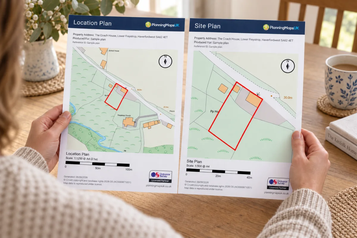
This workflow is built for straightforward projects like extensions, loft conversions, dropped kerbs and driveway updates. Search your address, draw the boundary, choose your scale, and download submission-ready files without specialist CAD knowledge.
If you are comparing suppliers, our os planning maps are designed for quick, self-serve ordering.
For Professionals
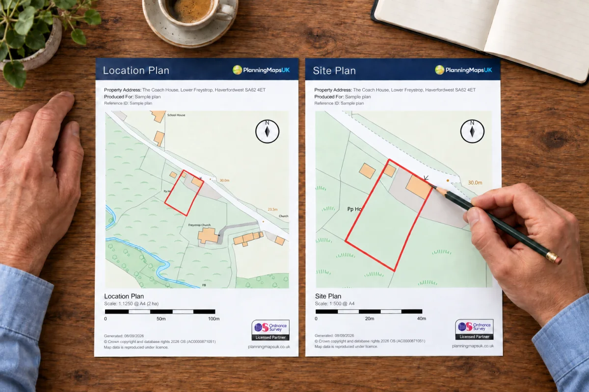
If you need technical outputs, you can generate map packs and export CAD formats for downstream design work. The platform is set up for repeat workflows, faster turnaround and cleaner handoff into project documentation.
Teams ordering os planning maps can move from address lookup to deliverables without switching tools.
Submission Confidence
PlanningMapsUK is built around the core checks councils apply to map documents. You still control your boundary and details, while the platform handles the structure and output format expected for planning submissions.
Our os planning maps workflow keeps homeowners and consultants aligned on compliance and file quality.
Current mapping source
Official Ordnance Survey MasterMap base mapping.
Planning-friendly outputs
PDF for submission and CAD for technical workflows.
Fast correction loop
Update boundaries quickly and regenerate when needed.
Helpful FAQs
Quick answers for homeowners, architects, and planning consultants.
These FAQs also cover practical questions around ordering os planning maps online.
Planning Tool
Use the decision tool if you are unsure whether to buy a site location plan, a block plan, or the full planning-map pack.
Scale Tool
Check whether your project needs 1:1250, 1:2500, 1:500, or a paired planning-map scale before you order.
Orders are placed through the online map tool so you can set the correct boundary and scale yourself. If you get stuck, contact support and we will help you complete the order quickly.
Checkout runs over HTTPS and payments are processed by Stripe. Card details are handled by Stripe rather than stored directly on our platform.
Most applications need a 1:1250 location plan and a 1:500 block plan. Larger rural sites may also need 1:2500 coverage.
Yes. Licensed OS-based planning outputs are the standard expected by councils, provided your boundary, scale, and map details are set correctly for the application.
You can order PDF outputs for submission, plus CAD formats (DWG and DXF) for design teams that need editable files.
A PDF is a standard document format that works on Windows, macOS, and most mobile devices. You can open it in a browser or a free PDF reader.
Yes. You can annotate the PDF in common PDF tools, or use the DWG/DXF files if your architect needs fully editable CAD layers.
Yes. The service is self-serve and available 24/7, including evenings and weekends.
Yes. You can review the map view, boundary area, and selected scale before checkout.
Most orders are delivered within seconds after payment. In heavier periods or with larger outputs, it may take a little longer.
It will print to the paper size you selected when ordering (A4 or A3). For scale accuracy, print at 100 percent or "Actual size".
No. Planning outputs are supplied as PDF for submission and optional CAD files (DWG/DXF); Word documents are not part of the output format.
For your planning application workflow, you can print as many working copies as you need from the downloaded file.
Yes. PDF, DWG, and DXF files can be shared electronically with your project team or uploaded to planning portals.
Yes. CAD exports are georeferenced to the British National Grid (OSGB36).
Gridlines are not usually included as a default overlay. Most CAD users add grid or layout references inside their own drawing template.
Yes. The map workspace offers larger PDF and CAD coverage options for bigger sites and land parcels.
We accept major debit and credit cards through Stripe checkout. Available wallet options may also appear depending on your device and browser.
Contact support with your order details and we will review it. If the issue is map-related and attributable to our service, we will correct it.
Yes. Use the My Plans area to retrieve earlier purchases and downloads.
Because map orders trigger licensed data and processing costs, change-of-mind and wrong-option orders are usually non-refundable. See our Terms for full refund rules.
Yes. You can add printed copies at checkout: A4 is £10 for 5 copies, A3 is £15 for 5 copies, and bundle orders can add 6 A4 copies for £10 with 3 of each plan.
Printed packs are queued for local hand-printing and then posted by Royal Mail. Once dispatched, typical delivery is 1 to 3 working days.
Not as a standard checkout option at the moment. Printed packs follow our normal Royal Mail workflow, so contact support before ordering if you have an urgent deadline.
A Trade Account is for professionals who order regularly and want features like volume pricing and account-based workflows.
No. We currently cover Great Britain (England, Scotland, and Wales). Northern Ireland mapping uses a separate data provider.
No free planning maps are offered, because licensed Ordnance Survey data and processing costs apply to every generated plan.
Usually not. Councils expect current licensed mapping, and unlicensed screenshots are a common reason for validation issues.